Project methods overview
Data Sources
List and describe data sources used, including links to cloud-optimized sources. Highlight permissions and compliance with data ownership guidelines.
-
National Land Cover Database (NLCD) by the USGS, with data from 2001-2019 updated every 2 or 3 years, this is the "the definitive land cover database for the United States." We are using the "Land Cover" map product – Conterminous U.S. land cover at a 30-meter spatial resolution with a 16-class legend based on a modified Anderson Level II classification system . This dataset is used to get ecosystem diagnostics.
-
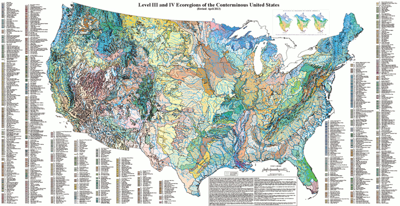
Level IV Ecoregions data from the EPA, who defines ecoregions as "areas where ecosystems (and the type, quality, and quantity of environmental resources) are generally similar." Level IV data has a granularity of 967 ecoregions in the conterminous U.S. We use this dataset to define the Southern Rocky region.

-
Landfire (LF) data is used to quantify our disturbance type. The LF program contains 25+ geo-spatial layers, including disturbance dates and types. We are subsetting for wildfire disturbance events. This data exists from 1999-2005.
-
Global Ecosystem Dynamics Investigation (GEDI) from the University of Maryland is an project that uses LIDAR from the International Space Station to profile ecosystems by ranging Earth's forests and topography. The L4 dataset contains gap-filled tree cover and canopy height variables which we will use to make our Carbon-related estimates before and after disturbance events. This data is only available between 2019 and 2023.
-
The R package
elevatris used to support terra elevation products from 3 sources: Amazon Web Services Terrain Tiles, Open Topography Global Datasets API, and USGS Elevation Point Query Service. Elevation data is used to subset our forest to the high-altitude sub-alpine region. -
NASA's Moderate Resolution Imaging Spectroradiometer (MODIS) satellite provides us with percent land cover information. 🛰️
Data Processing Steps
Describe data processing steps taken, the order of scripts, etc.
Once we've gathered our data, the processing steps are to:
-
Filter the NLCD polygons by the Southern Rocky region shapefile profided by the EPA Ecoregions.
-
Merge NLCD polygons into disruption categories. We will identify areas that experienced a single disturbance events of either insects or fires and areas that experienced no disturbance events. Disturbance interactions are too complicated for this short hackathon time frame and are removed for now.
-
Filter our disruption polygon between 9K - 11.5K feet (the sub-alpine regions) based on our elevation data.
-
Reclassifythe NLCD land cover categories to cover types that meet our research objectives. We kept all forest categories as forested land cover: deciduous, evergreen, and mixed. All other land categories (barren, shrubland, herbaceous, wetland) were reclassified as nonforest. The land cover categories are characterized by the Multi-Resolution Land Characteristics Consortium (MRCC).
Data Analysis
Using our polygons for burned and undisturbed regions in the high elevation southern rockies, we then did the following:
-
Crossed our data with GEDI for aboveground biomass estimates in each region
-
Calculated the total biomass using the area of each region
-
Estimated the total C in each region by dividing total biomass by 2, assuming about 50% of the biomass is C
Visualizations
We created maps showing the target regions with total biomass and highlighted regions with fire events.
Conclusions
We combined datasets with disturbance events, landcover types, and biomass to compare biomass and carbon differences in disturbed and undisturbed areas of high-elevation forests in the Southern Rockies.
Future steps we would take would include:
-
separating out forest types to examine C recovery in deciduous, evergreen, and mixed forest types
-
compare additional disturbance events to see how C recovery changes through time in different forest types
-
examine NPP/GPP changes over time in high-elevation forests
-
look at multiple disturbance types
References
- “Ecosystems Research: Ecoregions.” EPA, Environmental Protection Agency, www.epa.gov/eco-research/ecoregions. Accessed 13 Mar. 2024.
- Hollister, Jeffrey. Elevatr: Access Elevation Data from Various Apis, Comprehensive R Archive Network (CRAN), 12 Sept. 2023, cran.r-project.org/web/packages/elevatr/index.html. Home Page - Gedi, gedi.umd.edu/. Accessed 13 Mar. 2024.
- “LANDFIRE (LF).” LANDFIRE Program: Home, www.landfire.gov/. Accessed 13 Mar. 2024.
- Modis Land Cover Type/Dynamics, NASA, modis.gsfc.nasa.gov/data/dataprod/mod12.php. Accessed 13 Mar. 2024.
- “National Land Cover Database Active.” National Land Cover Database | U.S. Geological Survey, www.usgs.gov/centers/eros/science/national-land-cover-database. Accessed 13 Mar. 2024.
- National Land Cover Database Class Legend and Description, Multi-Resolution Land Characteristics (MRLC) Consortium, www.mrlc.gov/data/legends/national-land-cover-database-class-legend-and-description. Accessed 13 Mar. 2024.
- The National Map - Elevation Point Query Service, USGS, apps.nationalmap.gov/epqs/. Accessed 13 Mar. 2024.
- “OpenTopography for Developers.” OpenTopography, opentopography.org/developers. Accessed 13 Mar. 2024.
- “Terrain Tiles.” Terrain Tiles - Registry of Open Data on AWS, registry.opendata.aws/terrain-tiles/. Accessed 13 Mar. 2024.