Team 10 Home: Generating Finer Cropland Soil Moisture Content Maps Using Earth Observation Embeddings
-
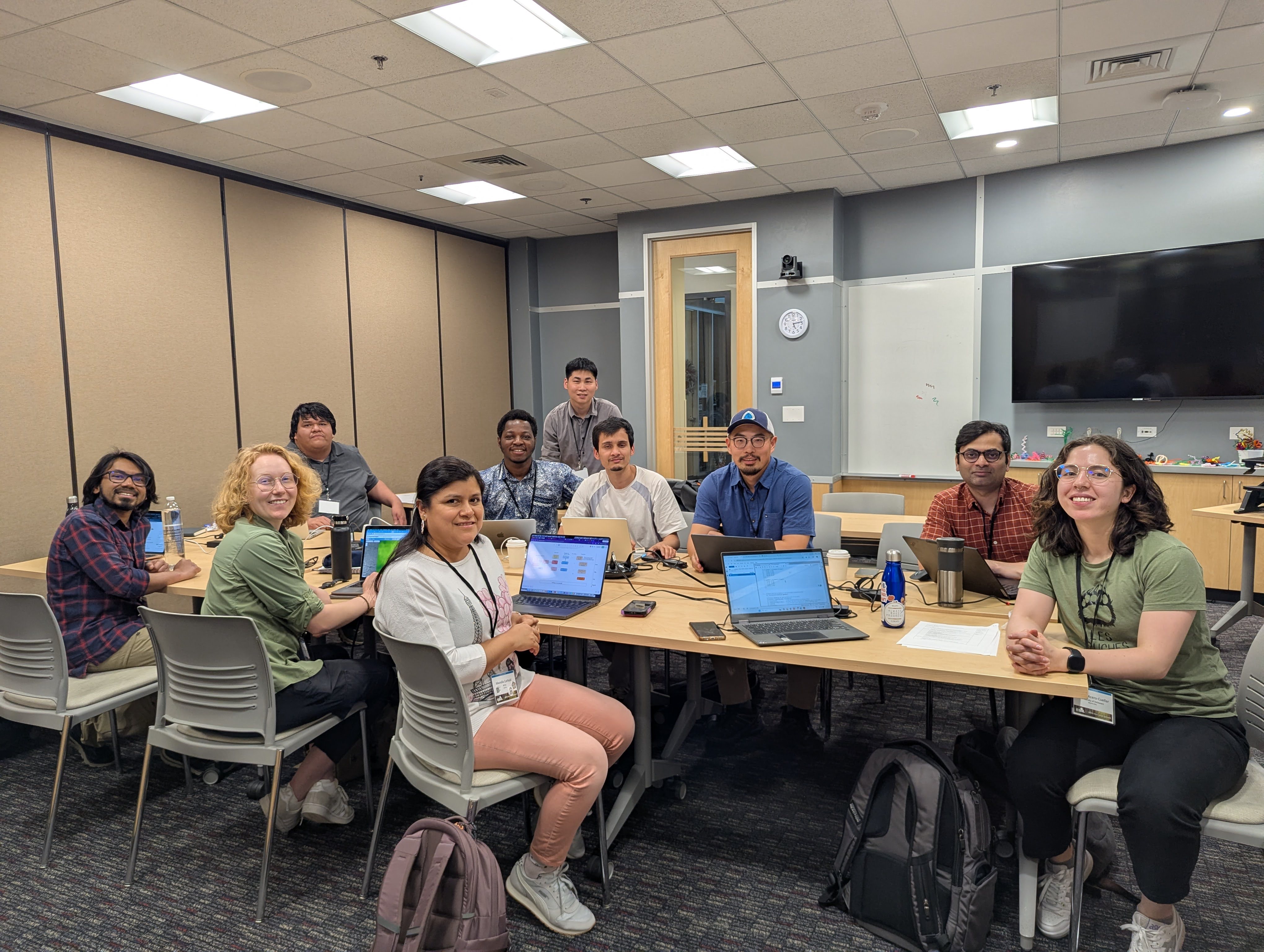
Team Photo
People
| Name | Affiliation | Contact | Github |
|---|---|---|---|
| Yi Yang | Colorado State University | yi.yang@colostate.edu | @y1y9ng |
| Aashish Gautam | Jackson State University | aashish.gautam@students.jsums.edu | @aashish66 |
| Mariella Carbajal Carrasco | North Carolina State University | mcarbaj@ncsu.edu | @carbajalmariella |
| Alice Heiman | Stanford University | aheiman@stanford.edu | @aliceheiman |
| Amos Abdulai | Livingstone College | abdulaiamos716@outlook.com | aabdulai116 |
| Mohammad Shahriar Saif | Colorado State University | ms.saif@colostate.edu | @saif8091 |
| Yu Peng | Indiana University | yp24@iu.edu | @eco-yupeng |
| Shashi Konduri | NEON/Battelle | konduri@battelleecology.org | @Shashi-konduri |
| Johnie plentybull | jplenty28637@olc.edu | ||
| Tatiana Acero-Cuellar | University of Delaware | taceroc@udel.edu | taceroc |
Our question(s) 📣
Our working question:
- Can Earth Observation Embeddings estimate soil moisture content at higher spatial and temporal resolutions than traditional ML/RS approaches?
- Can Earth Observation Embeddings also help improve the prediction of soil mositrure in deeper depths
Our final product:
- Data Product: Higher spatial and temporal resolution soil moisture map of agricultural areas in California. (starting 2017-2025)
- Academic Product: Paper
- Academic Product: a new framework that can gap fill fine temporal and spatial resolution soil mositure with existing field soil moisture measurements
What would count as progress:
- Specific question
- Roadmap and timeline for future work
- Potentially trying to produce some initial maps with Alpha Earth Foundations model
Hypotheses/Intentions
Our hypotheses is that: earth embeddings (which harmonize many different remote sensing data sources) could help us produce higher resolution soil moisture content maps
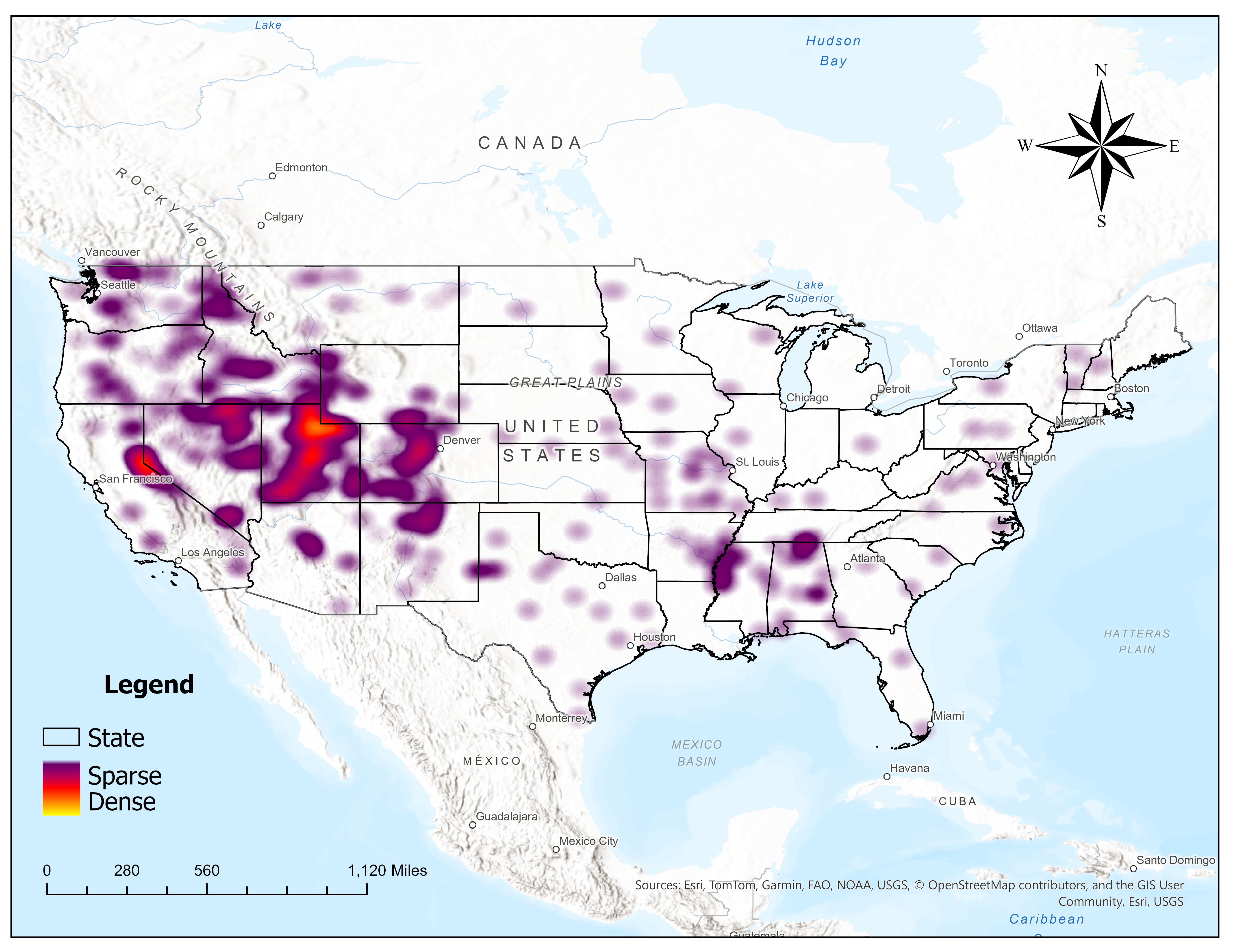
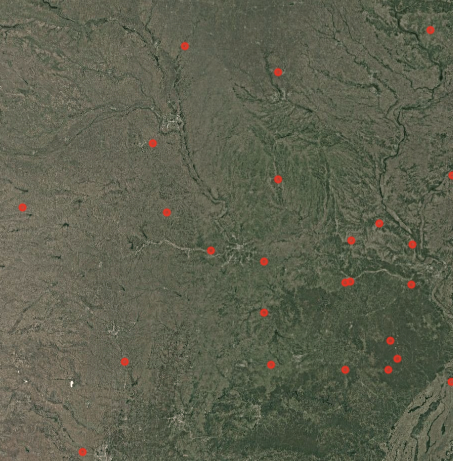
Study Area (Soil moisture Station Density Map)
Why this matters
This matters because:
-
For food security, we need to
-
High-value crops like grapes and corn are important for nutrition and agricultral export
-
Soil moisture information allow farmers and state-level officials to make more proactive management strategies, for instance in irrigation and drought-preparedness
-
California contains the Central Valley, one of the most productive agricultural regions in the US
People who could use this:
- Farmers, land-managements, state-level agriculture officials, food- and beverage industry
Promising data sources:
- Data source 1: SMAP L4 Global:https://nsidc.org/data/spl4smgp/versions/7
- Data source 2: SMOS: https://earth.esa.int/eogateway/missions/smos
- Data source 3: USGS In-Situ Soil Moisture sensor network for validation
- Data source 4: 30m Crop LULC Regions
- Data source 5: Alpha Earth Embeddings (which includes bands (C&L-bands) which are sensitive to soil moisture)
- Data source 6: Terra Torch Prithvi, Clay, and Terra Mind earth embedding models
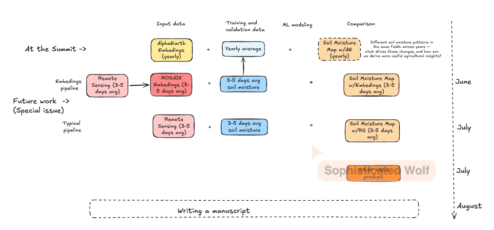
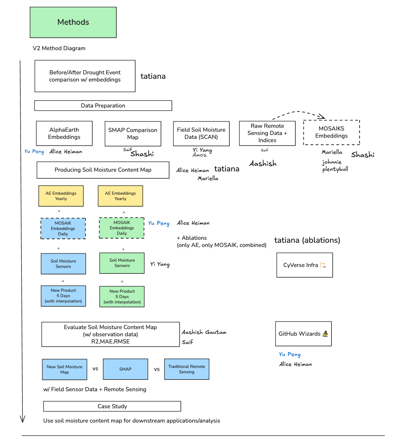
Methods/technologies 📣
To include earth embedding
Preliminary Results
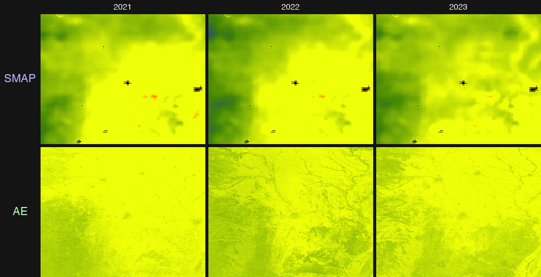
field observation data used for taining
The comparing: Trained regression via RF model ( AE vs SMAP)
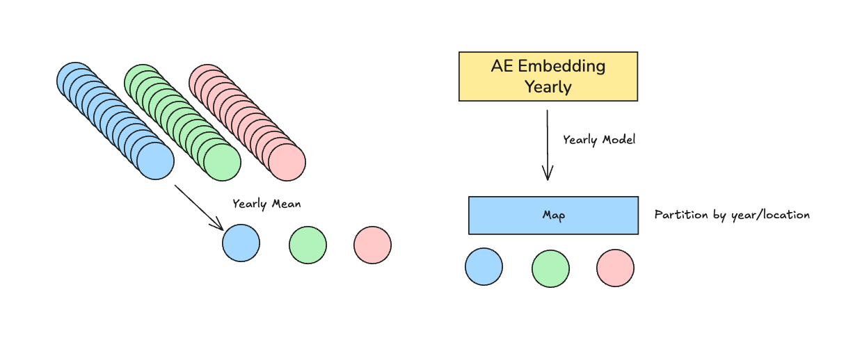
Top:AlphaEarth Embeddings using yearly field data
Bottom: SMAP (tranditional RS)
What’s next? 📣
-
Future workshop via ESIP cluster
-
Monthly meeting (emaillist / slack / Zoom / google storge)
-
Future workflow & roadmap