Library · Noun reference
roads
Mapped road features with provider-native geometry, identifiers, and classes.
Quick facts
| Fact | Value |
|---|---|
| Semantic type | Vector features |
| Units | Geometry in WGS84 degrees; project explicitly before measuring distance |
| Source flavors | overture, osm |
| Access | Explicit bounded acquisition; optional offline snapshot replay |
Usage
from cubedynamics.data.roads import roads

roads(*, source, bbox, release=None, snapshot_dir=None, offline=False)
The signature above is generated from the installed loader. Call acquisition before composing the analysis pipe.
Arguments
| Argument | Meaning | Default |
|---|---|---|
| source | overture or osm; preserves each provider's classes. | required |
| bbox | WGS84 west, south, east, north; <=0.02° per side. | required |
| release | Explicit release required for Overture; not accepted for rolling OSM. | None |
| snapshot_dir | Optional new directory to retain exact responses; use a new directory for a live refresh. | None |
| offline | Replay verified snapshots only; never download missing content. | False |
Available sources
| Source | Coverage | Resolution | Time |
|---|---|---|---|
| overture | Release-covered areas; bounded small-area queries | Native vector segments | Explicit release, e.g. 2026-08-19.0 |
| osm | Small query areas through Overpass | Native OSM way geometry | Rolling snapshot at retrieval; timestamp retained |
Differences among source flavors
Overture uses a pinned release; OSM is a rolling mapped snapshot. Native identifiers, classes, and segmentation differ and are not silently harmonized. Overture incorporates OSM, so agreement is not independent ground truth. Both remain vector features; neither implies traffic, legal access, or routing connectivity.
Returned data
A WGS84 geopandas.GeoDataFrame. Columns include geometry, source, source_feature_id, source_classification, name, and the complete provider record in native JSON. Attributes retain query bounds, source mode, interpretation contract and acquisition provenance. Features remain un-clipped until you explicitly clip them.
Order / grammar behavior
Use GeoPandas operations inside ordinary pipe callables or project-owned verbs. The lesson defines within_area and length_by_class; these are not new built-in verbs. Raster/time-series verbs and the cube viewer are not interchangeable with a vector workflow.
Minimal reproducible example
Live acquisition below requires network access and the source's optional dependencies. The complete offline lesson uses checksum-verified real inputs and shows a plot at every step.
from cubedynamics.data.roads import roads
import matplotlib.pyplot as plt

frame = roads(source="overture", release="2026-08-19.0",
              bbox=(-105.285, 40.008, -105.270, 40.020))
frame.plot()
plt.show()
See the data
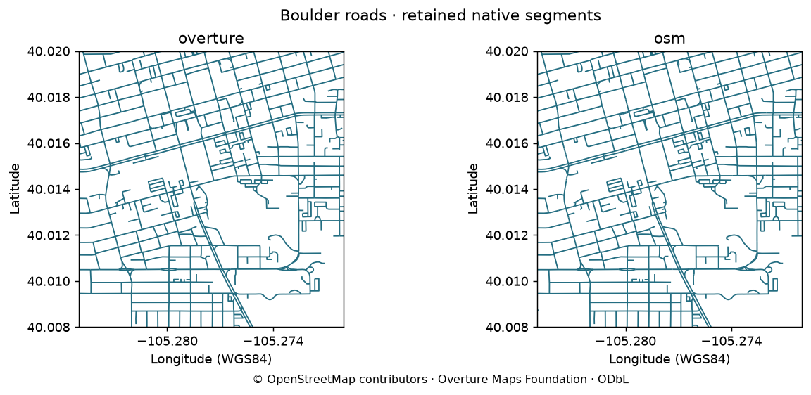
Code and interpretation · Figure and input hashes
Quality and provenance
Implemented and documented here as a scientific noun. Operational certification remains bounded: no production serving revision has been assigned. Retained real-data samples, numerical/schema checks, and replay tests are distinct from broad scientific suitability or live-service guarantees.
- overture: 5,000 features; 3 partitions; 4 row groups per partition; 400 requests / 40 MB bodies / 300 s. Install cubedynamics[roads] for PyArrow. Native classes/segmentation retained; not routing or completeness certification.
- osm: 5,000 features; 6 requests / 4 MB bodies / 90 s. Ways require a node inside the bbox: long crossing ways may be absent. Public Overpass is not a sustained application backend. No automatic road-class crosswalk.
Validation evidence and release gates. No automatic source switching or synthetic substitution.